


Table of Contents
It runs along the Iron Belt as it passes through Sopela and Berango, a simple and rewarding route with incredible views over the region of Uribe.
The section of the Iron Belt that joins Sopela and Berango gives us a nice tour of the Munarrikolanda range, a mountain of 255 meters high where we find shooter wells, machine gun nests, passive shelters and fortified sets. In short, a nice variety of military buildings that help us to get an idea of the harsh situation that the Basque people lived during the Civil War. The section of the Iron Belt that includes the municipalities of Sopela and Berango, is only an insignificant part of the great defensive complex that surrounded Bilbao, a small part of sector 5 (Larrabetzu – Berango). The Iron Belt defenses occupied more than 20 towns of Euskadi, unfortunately, the remains that are preserved today are not in the best of states. Even so, although their situation is not what we would like, many of these spaces keep alive the spirit of that time, a fact that makes them unique spaces in our land. A walk along any of the Iron Belt routes provides us with everything that history museums cannot show us. Thus, each section of this unique military complex is presented to us as a perfect complement to the Iron Belt Memorial, the museum of this historic defensive line.

What is the Iron Belt? Officially known as “Bilbao’s Belt” or “Bilbao’s Near Defense”. The Iron Belt of Bilbao is one of the most important military buildings of our territory. A barrier that protected Greater Bilbao from Franco’s army during the Civil War. This defensive line created by the first Basque Government has become by its own merits one of the emblems of resistance of the Basque people against the fascist troops.
What were the sectors of the Iron Belt?
- 1st Sector: Zierbena – Sodupe.
- 2nd Sector: Sodupe – Ugao.
- 3rd Sector: Ugao – Usansolo.
- 4th Sector: Usansolo – Larrabetzu.
- 5th Sector: Larrabetzu – Berango.
When did the Iron Belt stretch between Sopela and Berango come into play? Never. The Iron Belt was broken in Gamiz, Fika and Larrabetzu, more than 15 kilometers from this area, a fact that meant that this defensive barrier was never used.

With the aim of showing us as real as possible the aspect that Arene had during the Civil War, the municipalities of Sopela and Berango have carried out tasks related to the study, dissemination and enhancement of the Iron Belt in their territories. In addition, Berango has the so-called “Iron Belt Memorial Museum“, a space located in the cultural hall of Berangoeta, where we can appreciate a good number of war elements of that time. A space that helps us to understand the origin and operation of the Iron Belt, a highly recommended visit before venturing to discover the bowels of this historic defensive line.

Information on the Iron Belt between Sopela and Berango.
- Duration of the tour: 1 hour approximately.
- Difficulty: Easy. Familiar.
- Sector of the Iron Belt: Eastern Sector or Sector 5, Larrabetzu – Berango.
- Attractions: Military fortifications. Beautiful views.
- Location: Sopela and Berango.
Although the space occupied by the Iron Belt between Sopela and Berango extends through Munarrikolanda to reach the municipality of Erandio, today we want to show you a very simple and familiar route that only covers one end of this section. Thus, we will have the opportunity to merge this excursion with the visit to other spaces of the same theme (war/historical) as the Memorial of the Iron Belt or the walk between bunkers, trenches and cannons that we find next to the lighthouse of Gorliz.

Iron Belt between Sopela and Berango.
The route that we show you today is a small step in honor of all those people who lost their lives to protect their land from Franco’s troops. But it was not in Sopela and neither in Berango, since this front belonged to a second defensive line of the Iron Belt, a reserve line that never came into play in the battle to take control of Bilbao.

History: The history of the Iron Belt, full of heroes, traitors and villains, has tints of a war movie, a story worth mentioning. At the beginning of the Civil War, the newly created “army of Euzkadi” (Euzko Gudarostea in Basque) defended Euskadi from the fascist troops as best it could, because the superiority of Franco’s army was notorious (it had the help of the fascist armies of Italy and Germany). Faced with this, the Basque Government, led by the lehendakari José Antonio Aguirre, ordered the erection of the so-called Iron Belt, a great defensive barrier that would protect Bilbao, one of the great Basque strongholds. The more than 80 kilometers of perimeter of the Iron Belt had all kinds of defensive emplacements, from bunkers and trenches to machine gun nests.

This engineering work was directed by the engineering captains Pedro Murga and Alejandro Goicoechea (inventor of the Talgo). Unfortunately, the Iron Belt had its own weaknesses: stretches where it only had a rather weak or unfinished defensive line. Goicoechea, aware of its weaknesses and with access to all kinds of documents to prove it, betrayed the Basque people by crossing the front lines and handing over this information to Franco’s army. This is how the fascists managed to break the Iron Belt on June 12, 1937, taking advantage of the existing weakness between sectors 4 and 5 of the Gaztelumendi mountain, in Larrabetzu.

Objectives: The Iron Belt between Sopela and Berango responded to the need to defend the road linking the towns of Plentzia and Getxo while preventing the enemy from entering through the railroad. For this purpose, the easternmost reserve line was built in Arene and Urkomendi, a containment defense in case the first line, that of Barrika, failed. When the Iron Belt broke through Larrabetzu, these fortifications were abandoned by the army of Euzkadi.

Location: The section of the Iron Belt between Sopela and Berango is located on Munarrikolanda, the mountain that serves as a natural boundary between the two towns. A nice location, from which it is possible to enjoy the history of the Basque people while we do some exercise and enjoy the scenery offered by this small summit of 255 meters. In addition, this situation is perfect to take advantage and to know in detail the charms of towns like Sopela, Barrika, Plentzia or Gorliz among others.

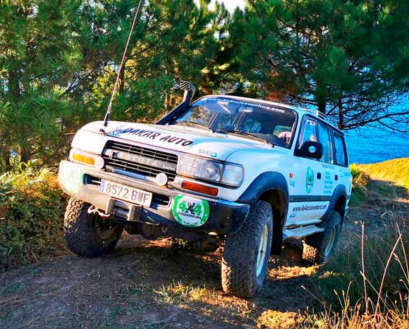
How to get there: There are two ways to get to Munarrikolanda, to the Iron Belt. From Berango and from Sopela. In our opinion, there is no color between both accesses. The one from Sopela with free parking, close to the subway and between green areas, stands out over the one from Berango, close to the road, between industrial pavilions and further away from public transport. Our recommendation is clear, much more comfortable to access from Sopela. Of course, although our recommendation is to access from Larrabasterra (Sopela), we are going to break down how to get to the Iron Belt from both municipalities.
Iron Belt from Berango.
- Road: If we want to get to Berango from Bilbao, the most advisable is to take the road known as “the advanced”, the BI-637 road, and later take the Berango corridor, the BI-634. Remember that the Berango exit is not the first one we find on our way (Getxo/Berango) but the second one, the one that indicates “Hondartzak /playasSopela Hegoaldea /sur”. Then, we only have to take the first exit at the traffic circle and take the first exit again at the next intersection to reach the Berango Shopping Center, where we can leave our car in one of the stores we find.
- Subway: The Berango subway, located in the center of the town, is a 15-minute walk from the shopping center, from where we access Munarrikolanda.
- Bus: At present there are no bus lines that link Berango with Bilbao directly, it is necessary to change buses. In any case, the Bizkaibus line A-3551 (Areeta – Armintza), has a stop next to the local health clinic (Landaida) from where you can easily reach the Shopping Center in about 5 minutes.
Once we have reached the Berango Shopping Center, we must access to the gas station that we find at the exit of the town and follow the side of the mountain by the track (stone/earth) that we find in the direction of Sopela. This is the track that leads directly to the machine gun nest of Berango, you can’t get lost.

Iron Belt from Sopela.
- Road: In this case the road is practically the same. We must take the BI-637 (the advanced) and link with the BI-634 (Berango corridor) to reach the Larrabasterra neighborhood of Sopela, up to the Urko sports center. The exit is the same, the only exception is that after the traffic circle we must continue straight on until we reach the next traffic circle, where we turn right. It is here, where we find a free parking (Sopela motorhome parking) where to leave our vehicle and from where the route of the Iron Belt begins in Sopela.
- Metro: The Larrabasterra stop, belonging to the municipality of Sopela, is the one with the best location to access the Iron Belt. From this point, take Urgitxieta street towards the Urko sports center, where you take the track that leads to the Munarrikolanda mountain range.
- Bus: As in the case of Berango, there is no bus linking Sopela with Bilbao, so the only option is to take the A-3451 Areeta-Armintza bus line and stop at Urgitxieta, next to the aforementioned sports center.
Once in the Sports Center of Urko (Larrabasterra), we must go to the back, by Munarrikolanda Ibilbidea until we reach the top of this small mountain. The route is perfectly signposted, there is no way to get lost. In addition, there is an area with grills and tables next to the sports center, which in summer offers a perfect plan to eat after the route.

Visit / route: Although there are guided tours of the Iron Belt as it passes through Sopela and Berango, they are not daily visits, they are not regular visits, but rather punctual. Therefore, a self-guided visit can be a great choice. If you choose this option, we recommend that in addition to help you with the information panels that we find in the access from Sopela and in articles like ours, you visit the Iron Belt Memorial Museum in Berango. The more information we have about what happened in this offensive line, the better we will be able to interpret the facts on the ground. Having said that, we begin our adventure through the Iron Belt by touring the area occupied by the house of the 5th Division of the Army of Euzkadi and the commander Pablo Beldarrain.

Tips for visiting the Iron Belt in Sopela and Berango.
- Mountain footwear.
- Comfortable clothing.
- Headlamp or flashlights.
- Camera.
The route starts at the Urko Sports Center, in Larrabasterra, next to the soccer field of the Ugeraga Sports Society. It is here, where Munarrikolanda Ibilbidea begins, we only have to follow the signs until we reach the dirt track that leads us to the first signs of the Iron Belt. The route, ascending but of little difficulty, makes us catalog this historical experience as “familiar”, a nice plan with which to learn while we enjoy. To reach our destination we just have to follow the road and take the right option in all the interceptions that we find. We leave you an unedited video in which you can perfectly appreciate the characteristics of the terrain, some of the fortified settlements and the views that we have from this section of the Iron Belt in Sopela and Berango. A good option if you want to see what awaits you in this “txoko” of Euskadi.
Although all the spaces have been conditioned and enhanced, the one that for us is the clear protagonist of the day is the machine gun nest of Arene, in Berango.

And is that this settlement of concrete machine gun and the trench from which it is accessed is one of the most real or best preserved of all sites that we travel during this route. In addition, it is one of the corners where the views over Sopela are best appreciated.

At the end of the route, very close to the machine gun nest of Berango, we find an ikurriña in honor of the mountaineers of the area, which can also be understood as a small symbol of Basque resistance. In addition to being next to the Iron Belt, it resisted the last fire that was unleashed in the area of Berango, near the Errementariena and Errementarienabarri baserris.
 If you want more, on the top of Munarrikolanda, near the summit, there is another much larger bunker that, although it dates from after the Civil War, you may be interested in visiting. As you can see, the Iron Belt in Sopela and Berango gathers a good number of fortified complexes. A small getaway in Bizkaia suitable for everyone.
0 Comments